

MAPS
Several versions of maps will be available, showing the tribal ownership of the riverbed. One set of maps was created by the Cherokee Nation GIS Dept. utilizing recent aerial photos and Corps of Engineers Navigational Charts. The Charts showing river mile markers and infrastructure were super-imposed upon the photo images. Then the GIS wizards added section, township, and range information to create a very usable series of maps.
We have organized these by Navigation Chart Numbers. They are very large images so beware of the download time. To make selection easier, we have made extensive notes to help you select the map you are interested in. Just click on the Chart Number you would like to see enlarged.
You can also view the original General Land Office Plats by clicking on This Link. BLM General Land Office Plats
![]()
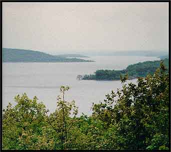
Arkansas Riverbed from Three Forks to Arkansas State Line
![]()
Chart 1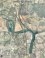 |
Includes the Three Forks area on the North edge of Muskogee, and the junction of the Muskogee Turnpike and Highway 62. The following sections are included:
|
Chart 2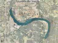 |
Includes the area from Highway 62, 3 Forks Marina, Mouth of Maynard Bay, and Gooseneck Bend. The following sections are included:
|
Chart 3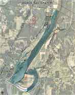 |
Includes the area from Camp Gruber, Hopewell Park, Mouth of Boudinot Bay, and Starr Lake. The following sections are included:
|
Chart 4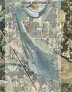 |
Includes the area from Spaniard Creek and Greenleaf Cove Public Use Area. The following sections are included:
|
Chart 5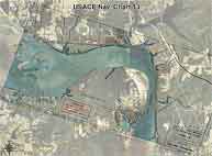 |
Includes the area from Greenleaf Lake and Webber Falls Lake Area. The following sections are included:
|
Chart 6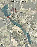 |
Includes the area from Webber Falls Lock and Dam, Webber Falls, and Gore. The following sections are included:
|
Chart 7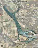 |
Includes the area from the Mouth of the Illinois River, Interstate 40, and Dirty Creek area. The following sections are included:
|
Chart 8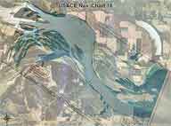 |
Includes the Mouth of the Canadian River and Robert S. Kerr Lake. The following sections are included:
|
Chart 9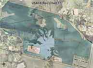 |
Includes part of Robert S. Kerr Lake and Tamaha, Ok. The following sections are included:
|
Chart 10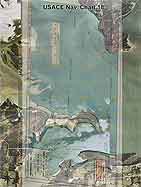 |
Includes part of Robert S. Kerr Lake. The following sections are included:
|
Chart 11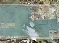 |
Includes part of Robert S. Kerr Lake. The following sections are included:
|
Chart 12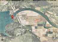 |
Includes part of Robert S. Kerr Lock and Dam, 59 H/W Bridge. The following sections are included:
|
Chart 13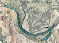 |
Includes part of the W. D. Mayo Lake and Kansas City Southern R/R. The following sections are included:
|
Chart 13-A Spiro Bend Area, Sections 2,3,4,9,10, & 11
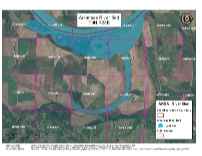


Chart 14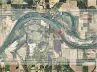 |
Includes W. D. Mayo Lock & Dam, Old Fort Coffee, Wilson Rock Park, Braden Park The following sections are included:
|
Chart 15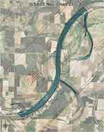 |
Includes The Arkansas River The following sections are included:
|
Chart 16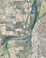 |
Includes Moffett and Fort Smith, Arkansas and Garrison River Bridge. The following sections are included:
|